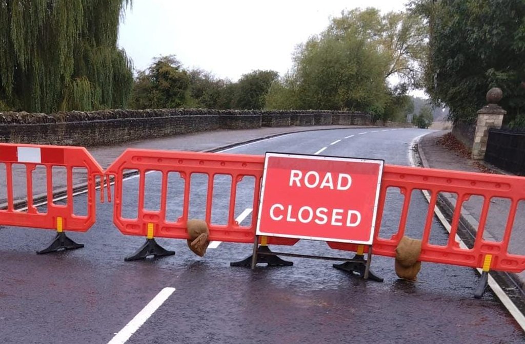
After another wet night, and as previous rainfall swells rivers and other waterways across Bedford Borough, several more roads have closed.
This morning, Bedford Borough Council issued several road closure warnings, which are likely to cause further traffic disruption in the area as motorists try to get to work, school and other destinations.

Roads
The roads currently closed are,
- Paula Radcliffe Way (A6) both directions (further details below)
- High Street, Clapham
- Lovell Road, Clapham
- Mill Road, Sharnbrook
- Harrold, Oakley, Felmersham and Radwell bridges
- Oakley Road, Bromham (due to emergency works by UK Power Networks)
There is also a warning to take care on the A6 at Milton Ernest which is ‘passable with care due to surface water’.
The A421 remains closed and is like to remain closed for some time after being submerged in water over eight feet deep.
Specific closures for Paula Radcliffe Way are
- Northbound – Closed from Clapham Roundabout (Sainsbury End) to Lovell Road Oakley slip. Vehicles can access the exit slip road from Highfield Road onto A6 heading North.
- Southbound – Closure points – A6 Sharnbrook Roundabout, diverting traffic onto C26 Thurleigh Road. Another hard closure has also been put in place Junction of Thurleigh Road Milton Renest to further warn of the closure.
In a post on social media this morning, a spokesperson for Bedford Borough Council wrote, ‘We are currently changing over our drainage crews and our priority is to continue to try and remove surface water from Paula Radcliffe Way to be in a position to reopen a lane north and southbound.
‘We are committed to getting these roads open as quickly as we can. However, as we are still experiencing heavy rainfall in Oakley/Clapham presently and with adjacent land flooded we are facing an uphill battle to not only remove the surface water but deposit it elsewhere nearby.’
Schools
Some Bedford Borough schools are closed too, with the following turning pupils away.
- Grange Academy (last update Wednesday, 25 September)
- Lincroft Academy (last update, 7.20am Friday, 27 September)
- Sharnbrook Academy (last update 7.20am Friday, 27 September)
Flood warnings
The Environment Agency has also raised the number of flood warnings, meaning flooding is expected, from five to six. Warnings are now in place for
- Areas close to the River Great Ouse at Wyboston, Eaton Socon, Eynesbury, Eaton Ford, and St Neots
- Low-lying areas close to the River Great Ouse at Bedford
- River Great Ouse at Harrold
- River Great Ouse at Odell
- River Great Ouse at Turvey
- Low-lying areas close to the River Great Ouse at Kempston
The is also an increase in flood alerts, which means flooding is possible, from yesterday with three now in place for,
- Middle River Great Ouse in Milton Keynes, Bedford Borough and Central Bedfordshire
- River Great Ouse in Central Bedfordshire, Beds Borough and Cambridgeshire from Wyboston to Brampton
- Riseley Brook in Bedford Borough
The floods have heightened fears for some Bedfordians who say that more will come if council planners allow developments on floodplains in the area.
Take care
Bedford Borough Council has also reissued safety advice to motorists warning them that, “Driving in heavy rain and flooding can be hazardous”.
They ask everyone to first consider if their journey is essential, and if it can be delayed until after the rain has subsided.
If the journey is essential, motorists are advised to plan in advance, taking care to avoid areas which are prone to flooding and factor in extra time to allow for slower speeds and potential congestion.
“Do not walk or drive through flood water. Flood water may contain sewage and hide rubbish, wreckage, uneven roads and pavements or broken drain and manhole covers,” add a spokesperson for the council.
They also ask motorists to remember that “driving through flood water can negatively impact neighbouring properties”, and remind people not to remove road closure signs. “The signs are there for your safety,” added the spokesperson.
For further advice, head to the Met Office website which has a page dedicated to driving in severe weather.
For more information and advice about what to do in a flood visit bedford.gov.uk/flood.